Services
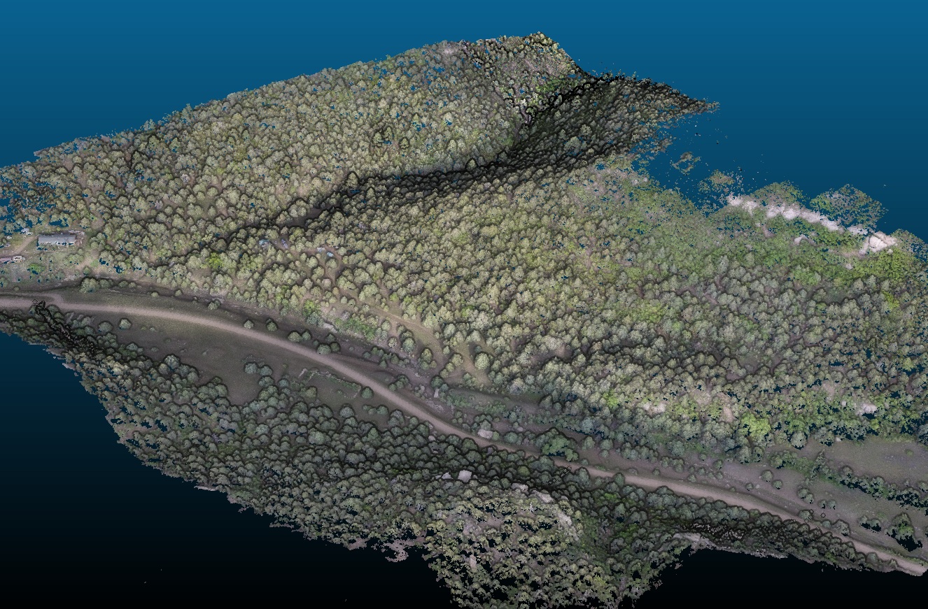
LiDAR SLAM
Detailed 3D scans indoors or outdoors, capturing buildings, facilities, and environments with high precision. Perfect for construction, renovations, facility management, and creating digital twins.
Ouster/Livox RTK Above-ground / Underground Custom Built SolutionsDrone Surveys
Aerial mapping & photogrammetry for volumetrics, site planning, and progress tracking. FAA-compliant operations.
GCP/RTK Orthos & DSM3D Modeling
Precise CAD and mesh models from scans or concepts. Drafted parts, prototypes, and environment models delivered in preferred format Ready for BIM, design review, game engines, or web.
Solidworks Fusion 360 2D / 3D3D Printing
Functional prototypes and small-batch parts engineered within project-optimized design and material constraints, ensuring the right balance of performance, cost, and accuracy.
FDM/SLA Rapid Prototyping Printer Installations & RepairSolutions in Action
Any-Scale LiDAR SLAM
Comprehensive 3D mapping for above-ground, underground, and mixed environments. Closed-loop SLAM registered to survey control, delivering high-fidelity models with high accuracy.
Drone Mapping
Aerial surveys with drone imagery, producing detailed maps and elevation models for site planning, inspections, and progress tracking.
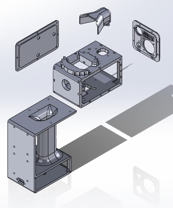
3D Modeling
From raw scans or concepts to polished, accurate 3D models. Ready for environments, prototypes, or digital twins in the format you need.
Contact
Tell us about your project
MSP3D
Minneapolis — Saint Paul, MN
Serving the Twin Cities and Upper Midwest with a one-stop solution for 3D needs — from LiDAR scanning and environment capture to CAD modeling, BIM integration, and rapid prototyping with 3D printing. Fast, accurate, and project-ready deliverables tailored to your goals.
- 3d@msp-3d.com
- Mon–Fri, 8am–6pm CT